Route-informatie
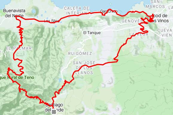
A loop through one of the greenest parts of the island.
At the end of this tour, you'll have to try to climb the Masca Wall!
GPS route
A loop through one of the greenest parts of the island. At the end of this tour, you’ll have to try to climb the Masca Wall!
Routeanalyse
Beweeg over het profiel om afstand en hoogte te bekijken.
Meer dan de kerncijfers
Berekend uit langere delen van het routebestand. Rijtijden zijn planningsschattingen, geen gemeten prestaties.
823 m gestegen · ongeveer 4.2% gemiddeld
Begint rond km 54.3
Begint rond km 54.3
1.991 m klimmen per 100 km · hoogste punt bij km 5.6
Pas deze route aan
Maak een persoonlijke kopie zonder de originele Bike Point-route te wijzigen.
Rijd hetzelfde traject in de tegenovergestelde richting.
Kies voor deze lus een ander punt op het traject als start en finish.
!De download is een door de bezoeker aangepaste kopie. Controleer voor vertrek wegen, paden, toegang en weersomstandigheden.
A loop through one of the greenest parts of the island.
At the end of this tour, you'll have to try to climb the Masca Wall!