Routenhinweise
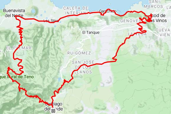
A loop through one of the greenest parts of the island.
At the end of this tour, you'll have to try to climb the Masca Wall!

GPS route
A loop through one of the greenest parts of the island. At the end of this tour, you’ll have to try to climb the Masca Wall!
Streckenanalyse
Bewege dich über das Profil, um Distanz und Höhe zu prüfen.
Mehr als die wichtigsten Zahlen
Aus der Routendatei anhand längerer Abschnitte berechnet. Fahrzeiten sind Planungswerte, keine aufgezeichneten Leistungen.
823 m Anstieg · etwa 4.2% im Durchschnitt
Beginnt ungefähr bei km 54.3
Beginnt ungefähr bei km 54.3
1.991 m Anstieg pro 100 km · höchster Punkt bei km 5.6
Route anpassen
Erstelle eine persönliche Kopie, ohne die Originalroute von Bike Point zu verändern.
Fahre dieselbe Strecke in der entgegengesetzten Richtung.
Wähle bei dieser Rundstrecke einen anderen Punkt als Start und Ziel.
!Der Download ist eine vom Besucher geänderte Kopie. Prüfe vor der Fahrt Straßen, Wege, Wetter und Zugangsbedingungen.
A loop through one of the greenest parts of the island.
At the end of this tour, you'll have to try to climb the Masca Wall!