Indicaciones de la ruta
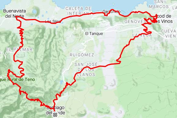
A loop through one of the greenest parts of the island.
At the end of this tour, you'll have to try to climb the Masca Wall!
GPS route
A loop through one of the greenest parts of the island. At the end of this tour, you’ll have to try to climb the Masca Wall!
Análisis del recorrido
Desplázate por el perfil para consultar distancia y altitud.
Más allá de las cifras principales
Calculado desde el archivo de ruta usando tramos sostenidos y no pendientes ruidosas entre puntos. Los tiempos son estimaciones de planificación.
823 m de ascenso · aproximadamente 4.2% de media
Comienza aproximadamente en el km 54.3
Comienza aproximadamente en el km 54.3
1.991 m de ascenso por 100 km · punto más alto en el km 5.6
Adapta esta ruta
Crea una copia personal sin modificar la ruta original de Bike Point.
Recorre el mismo trazado en la dirección contraria.
En esta ruta circular, elige otro punto del trazado como salida y llegada.
!La descarga es una copia modificada por el visitante. Comprueba el estado actual de carreteras, senderos, accesos y meteorología antes de salir.
A loop through one of the greenest parts of the island.
At the end of this tour, you'll have to try to climb the Masca Wall!