Route guidance
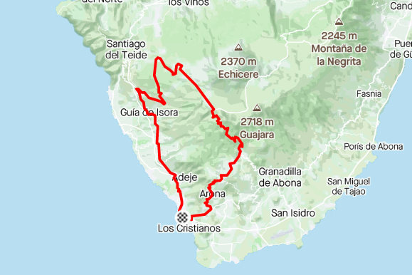
Start at our shop in Las Americas and go up to El Teide through Chio, the easiest way to climb the mountain.
To get back to our shop, you'll go over the top and down through Vilaflor and Arona.

GPS route
Start at our shop in Las Americas and go up to El Teide through Chio, the easiest way to climb the mountain. To get back to our shop, you’ll go over the top and…
Track analysis
Move across the profile to inspect distance and elevation.
Beyond the headline numbers
Calculated from the route file using sustained sections rather than noisy point-to-point gradients. Riding times are planning estimates, not recorded performances.
1,544 m gained · approximately 5.3% average
Begins at approximately km 34.9
Begins at approximately km 47.7
2,705 m climbing per 100 km · highest point at km 56.1
Adapt this route
Create a personal copy without changing Bike Point’s original route.
Ride the same track in the opposite direction.
For this loop route, choose another point on the trace as your start and finish.
!Your download is a visitor-modified copy. Check current road, trail, weather and access conditions before riding.
Start at our shop in Las Americas and go up to El Teide through Chio, the easiest way to climb the mountain.
To get back to our shop, you'll go over the top and down through Vilaflor and Arona.